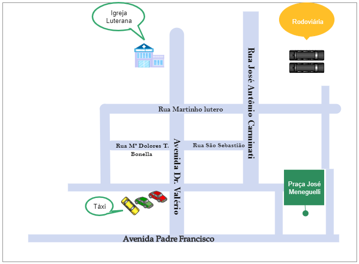
The Eng city map is a small-scale graphic representation of the city and all its places. It is used to offer a quick orientation of the urban area as well as provide a sense of direction. Things that are included in the city map include the street network, the street names, landmarks, buildings, waterways, and parks. Other things found in the city map are attraction sites available in the area, cultural buildings or institutions, schools, hospitals, churches, transport, and other public facilities. The city map is made up of different colors, each representing a different item, and these are described in the key.


 Desktop