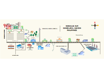
Here's a directional map for community hazard. A map is a visual depiction of a complete region or a portion of an area that is often shown on a flat surface. A map's purpose is to depict precise and detailed aspects of a certain location, most commonly used to show geography. There are several types of maps, including static, two-dimensional, three-dimensional, dynamic, and interactive maps. Political borders, physical characteristics, roads, geography, population, climates, natural resources, and economic activity are all shown on maps.


 Desktop