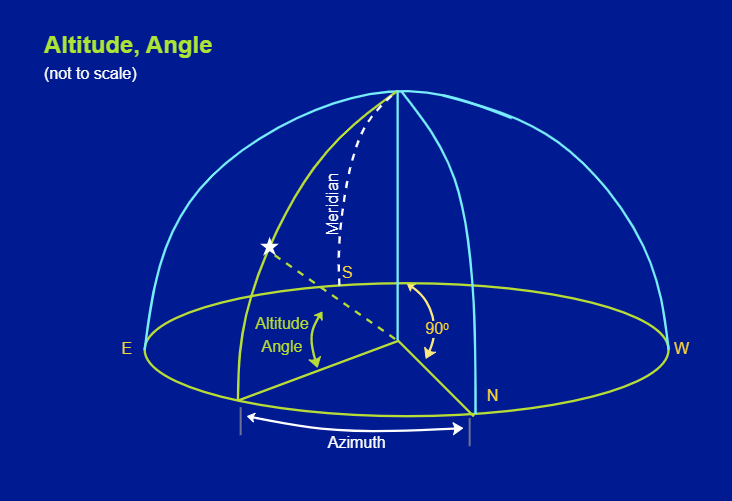
This altitude and angle astronomy diagram depict two coordinates describing an object's position above Earth. Altitude, in this sense, is shown as angular elevation above the horizon, while Azimuth is the number of degrees clockwise from due north to the vertical circle of an object (i.e., a great process through the thing and the zenith). As shown in this altitude and angle astronomy diagram, latitude and longitude are coordinate systems that can be used to determine and describe the position or location of any point on the Earth's surface. Latitude measures the place north or south of the Equator on a globe or map. Technically, there are three types of latitude: geocentric, astronomical, and geographic (or geodetic), but the distinctions are minor.


 Desktop