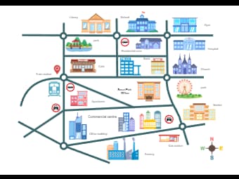
Here is an illustrated city map that details the locations of various public services and amenities. It features icons for a library, school, gym, hospital, church, park, café, residential area, apartment buildings, office buildings and a gas station. Additionally, the map includes transportation nodes like a train station, depicted with a location marker. This layout is designed to provide a user-friendly overview of the city’s infrastructure, helping residents and visitors locate essential services and points of interest.


 Desktop